“Stick to the feeders, not the drainers.”
The advice comes from Bones. The feeders gain water and the drainers splinter off, leaving you high and dry.
We’re on day two of a 12-day float down Alaska’s Alsek River, which cuts through the heart of the Yukon’s Kluane and Alaska’s Glacier Bay national parks. The trip’s as puzzling logistically as its braids. It involves a boondocks put-in, a helicopter portage, a weather-dependent bush plane flight out at the ocean, and adapting to a garrison of other geological hurdles.
In all, we’ll lose 2,000 feet of elevation in 185 miles, riding a silt-laden conveyor belt through some of the most spectacular wilderness on the planet. The river cleaves through the largest coastal mountain range in the world, as well as the planet’s largest non-polar icecap. Peter, our token geologist, says its geology is more interesting than the Grand Canyon.
That’s assuming we make it through the Prisoner’s Dilemma in front of us. There are 15 of us, all paddling our own AIRE inflatable kayaks laden with gear. The gear choice is the brainchild Bones’ brother Corvs, a perennial hard guy who’s summited Mt. Rainier 52 times. A sort of Pied Piper of Paddling, he’s led his Seattle-area friends on similar trips before, including one 10 years earlier down the Alsek. We’re all near 50-somethings, from an ex-NFLer with two Super Bowl rings to a cop, ski patrol and president of a glue company. One guy along lost his wife, job, house and hairline all in the past year. Right now, however, we’re as spread out in various channels as we are in our walks of life.
We regroup at Marble Creek, just in time to set up two tarps against the impending rain – a chore we’d get quite good at – and the portable, zap-you-if-you-touch it electric bear fence for our food. As if its glaciers, Amazon-style volume and remoteness aren’t enough, the river also harbors the continent’s densest concentration of ursus horribilis.
Still, now that we’re on the river, things are less hectic than they were in Haines, where we had to find the gear we’d shipped up a month earlier and organize and pack our food. At dinner, friend Stan Boor, who made the first raft descent of the river and, as co-founder of Sobek Expeditions, has run rivers all over the world, affirmed it was all worth it. “To one of the best river trips in the world,” he toasted.
Dropping his badge on the counter, Gary the Cop helped grease our way through customs on the five-hour drive to Haines Junction. After sorting our gear, we put on the Dezadeash River, which joins the Kaskawulsh to form the Alsek.
The river served up a lesson in its wilderness stature early. Glacial gusts forced us to tether our boats to our backs and pull them along the bank. A guide I’d met told me it once took them three days to get the first 10 miles. We were lucky to get to Marble as easily as we did.
On day three we head straight into Tolkien’s Mordor, clouds cloaking the mountains as we whisk by. The hiss of glacial silt beneath our hulls sounds Gollum-like.
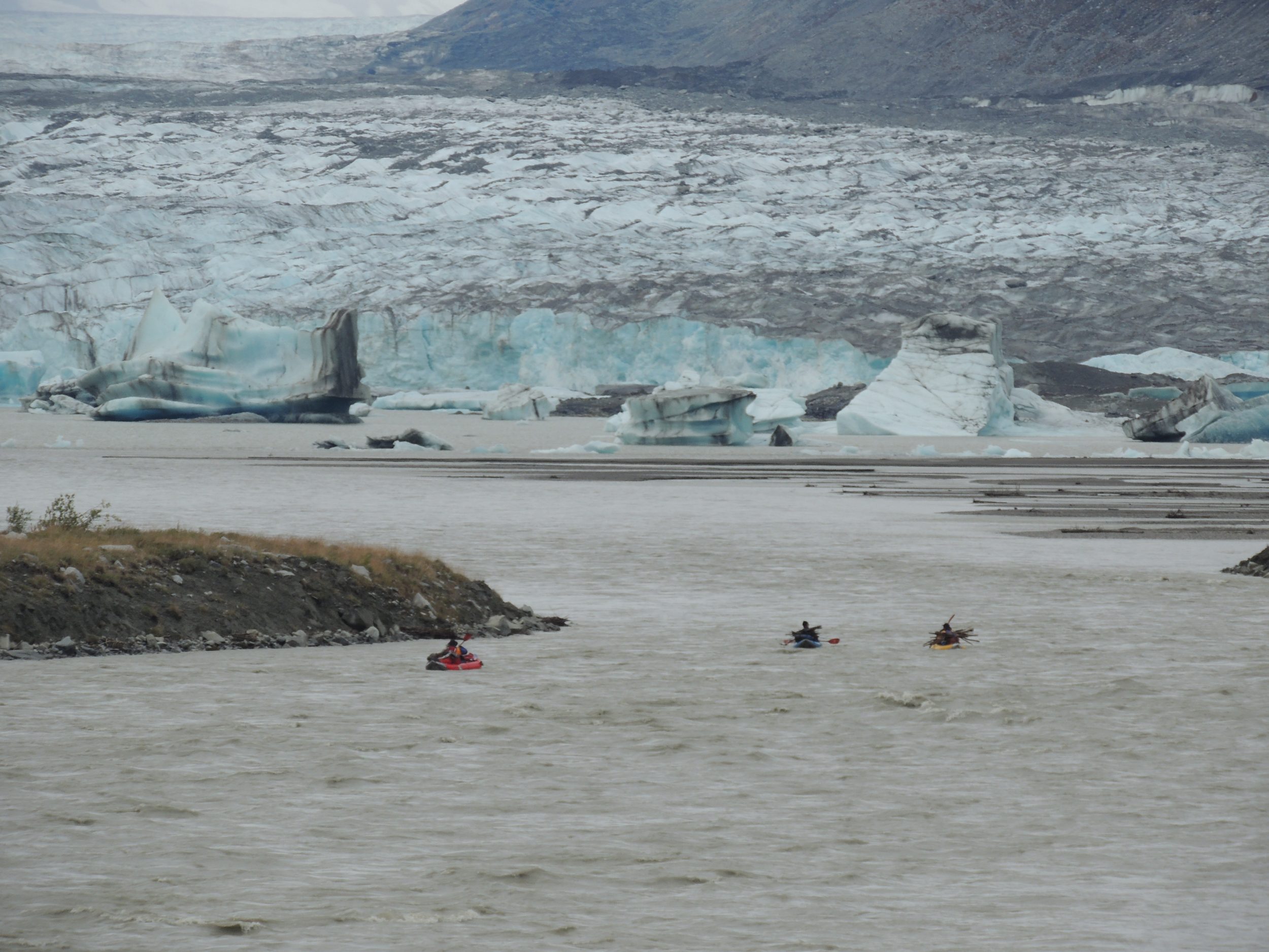
The region’s scale truly sets in when we enter Lowell Lake, formed by its namesake glacier. Not long ago, it surged forward, turning the Alsek into a lake extending 60 miles upstream, burying the current-day site of Haines Junction in the largest ice-dammed lake in North America. You can still see the bathtub ring that ate into the vegetation 300 feet up the hillside. Doting the lowlands are “erratics,” giant boulders carried up the lake atop even bigger icebergs. One look and you can tell they simply don’t belong. And Lowell’s still a tad neurotic. Just 15 years ago it surged back across the lake, squeezing the river like a vice.
We spend two nights at one of the most beautiful campsites on the planet, Lowell rumbling out the front door and out the back, an unnamed, 2,500-foot waterfall careening down Goatherd Mountain, which we climb the next day. The following morning, we rig to flip, facing two of the trip’s largest, Class IV rapids. Threading a maze of massive, blue icebergs blocking our route, we eventually hit the current again. A few bergs fall prey to the current and chaperone us downstream.
A Class III wave train leads us to the first rapid, Sam’s, which we Brave Sir Robin around by taking a channel to the right. But this brings another obstacle: our first bear. Thankfully, after standing on its haunches, it scampers up the bank before we pass by. Re-joining the main current, we see a giant iceberg emerge from the rapid, a little worse for the whitewater wear. Lava North is even bigger, living up to its Grand Canyon namesake with a series of gut-wrenching holes. After scouting, we sneak it by bouncing down a stair step of rocks on the left.
Craig scores an Alaskan hat trick with three flips for the day. He’s able to right his boat and climb back in on the first two, but despite his drysuit the third swim takes its toll and I paddle over to help. Dave and Kevin, the lineman once pictured on the cover of Sports Illustrated alongside the headline “The NFL’s Dirtiest Players,” come in just behind him at two flips each.
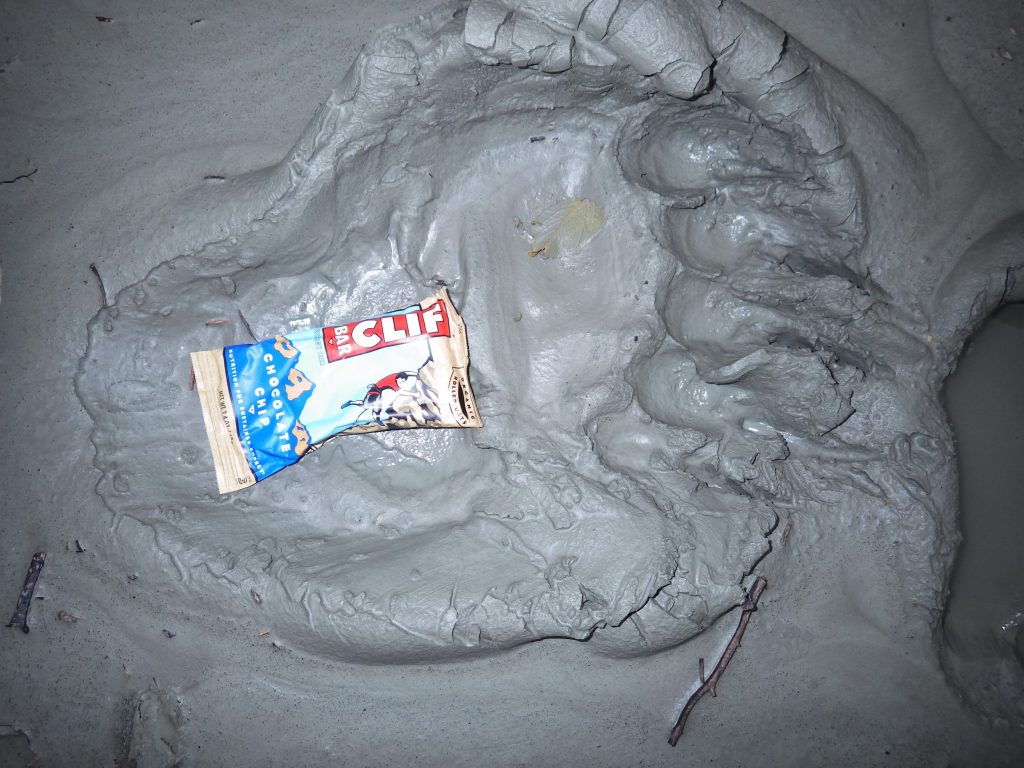
We camp at Fisher Glacier which, like the others, is littered with bear tracks. It makes me wonder how many there are elsewhere. Then we while the night away playing guitar under the northern lights, which make us feel guilty about heading to bed.
In the morning, we hit Serebus, a rapid named for the three-headed dog in Homer’s Odyssey. It’s easy to get distracted by the scenery and not pay attention to the task at hand. I barely see a horizon line in time to straighten my boat and punch through a hidden hole. Soon we pass Range Creek. A long time ago when the Tweedsmuir Glacier surged, it dammed up the river so it flowed up and over its 800-foot pass and down Detour Creek into the Tatshenshini drainage. The scale of such an event is mind-boggling.
Turnback Canyon
The glacier responsible shows itself around the next bend, its serrated face comprising the entrance to Turnback Canyon. We camp at the canyon’s brink at the foot of Mt. Blackadar, named for the Walt Blackadar, the first person to kayak the Class V big-water badge of courage solo in 1971. We rest easy knowing we’re not running it.
The whop-whop of the helicopter comes right on schedule at 9 the next morning. The pilot is Dion Parker, whose parents live in Steamboat. I tell him I’ll put in a good word. The portage takes six trips, three with long lines and three with people. From the air it’s hard to tell what’s more formidable, the canyon or glacier. Both are equally white and rumbling.
A snowstorm of dandelion-like Dryas seeds clouds the air when we land. It’s the first time Dion has dropped anyone off here all year. Re-rigging our gear, we put back in on a tributary pouring out of the glacier and ride a ribbon of white down to the main river. Two more brown bears appear before we reach the confluence of the Tatshenshini, which betters even Lowell as a campsite. For 360 degrees, hanging glaciers cling to jagged mountaintops, save for where the massive Melbern Glacier has its way with the mountains. Guidebook author Russ Lyman calls the sensation we’re feeling “Scenic Overdose Syndrome.” The topo maps show only 500-foot contour lines, meaning 400-foot cliffs don’t even register. In 1852 when Lowell surged, the resultant flood drowned a tribe of Athabascan Indians living here.
Bones clocks our maximum speed the next day at a whopping 12 mph, on flat water. At one point we can see 20 different glaciers at the same time. At a camp called Purple Haze, named for its fireweed blooms, we finally see 15,300-foot Mt. Fairweather, shark-finning three vertical miles above us.
Our final crux is Alsek Lake, formed by the Alsek and Grand Plateau glaciers. Its three-route entrance is affectionately known as the Channel of Death. A few days earlier a commercial trip took the wrong “door” leading into it and got trapped by bergs for three days. Tales tell of the lake’s shifting icebergs lifting rafts up onto them and even stranding bears. It feels odd scouting the far right channel for icebergs instead of rapids. Fortunately, our path is clear.

After a last dinner of Everything Chowder, we’re up at 4 a.m. to headlamp paddle the final 20 miles out to Dry Bay where we’ll meet a bush plane on a cobblestone landing strip. A gauge later shows that the river is now running 130,000 cfs, nearly 10 times the average release on the Grand Canyon. Floating alongside icebergs in the eerie pre-dawn darkness, I hear the tell-tale crash of whitewater ahead. It’s a giant berg stuck on the river bottom, creating its own hydraulic.
“Cutting it a little close, aren’t you?” asks the ranger when we finally paddle up to the strip just 15 minutes before the plane arrives. Indeed we are. But in such a wilderness, there’s not much wiggle room for anything.


